Castle Cluggy at Ochtertyre

Castle Cluggy
( written in 1880
by the Rev William Marshall in his book Historic Scenes of Perthshire )
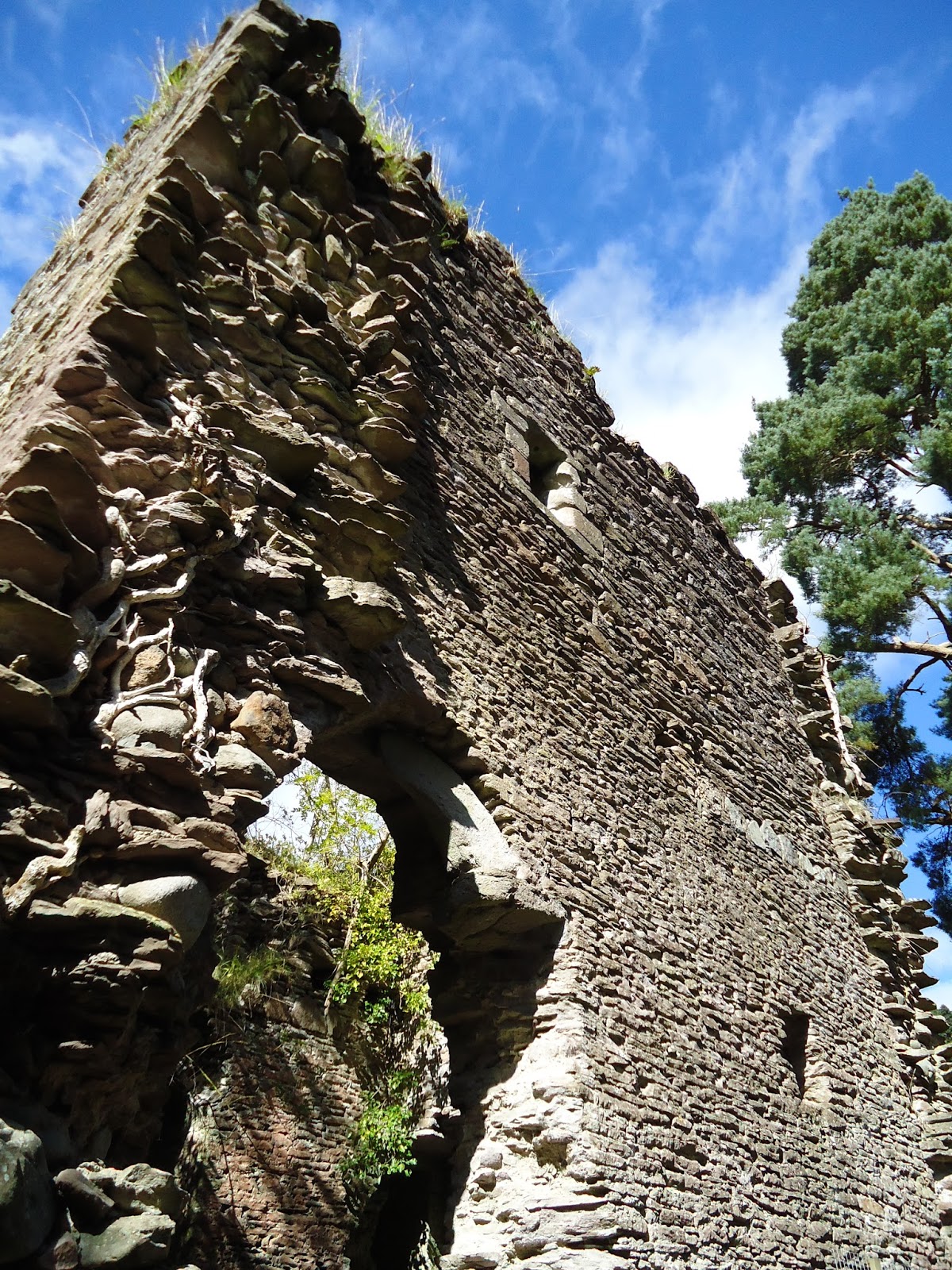
“ Castle Cluggy on the peninsula on the north of the Loch
of Monzievaird ( pronounced mony- vaird ) is a very old erection When it was
built is not known but it was old upwards of four centuries ago. In the
Charter giving Ochtertyre to the Murrays
, and bearing the date of 1467 , it is
described as an antiquum fortalicium
. It is now reduced to a square tower of about seventeen feet by eighteen , within walls ; but it was once
very much larger . Its walls are five to six feet thick and as hard as adamant
. In olden times the peninsula on which it stands was an island , separated from
the bank of the Loch by a narrow isthmus
over which was drawbridge , so it must
have been a fortalice of great strength .
If tradition may be credited , this castle may well be regarded as an Historic Scene ;
for it is said to have been a seat of the Red Cumin ( Comyn ) , the rival of
Bruce for the throne , and whom Bruce killed at the High Altar of the Convent
of the Minorities at Dumfries .However this may have been, certain it is that
Sir William Murray, the First Baronet of Ochtertyre , made Castle Cluggy his retreat
for some time during the ascendancy of Cromwell. Moreover , the artificial islet , formed of stones
,and supported by oak trees , about eighty yards distant from the Castle , tradition
represents as being the prison attached to it .”


Report by
Canmore ( Royal Commision on the Ancient and Historical Monuments of Scotland
The OS grid reference
for the castle is : NN 83977 23401
In July 2001 an archaeological evaluation of the remains
of Castle Cluggy (NMRS NN82SW 1), near Crieff, was carried out in advance of
the consolidation of the structure. The evaluation involved the hand-excavation
of trenches both within the structure and to its E in order to ascertain the
nature of deposits within the castle; the relationship between the original
walls, and the later, possibly 17th-century E wall; and the original extent of
the castle.
The castle consists of a ruinous three-storey stone-built
tower, measuring roughly 8.6m N-S by 8.1m E-W. The walls are generally 1.5m
thick, with the replaced E wall having a thickness of just 0.95m. The N and S
walls obviously continued further E in earlier times, but there were no signs
in the grounds surrounding the building of their former course.
The evaluation required the hand-excavation of six small
trenches. The interior of the building contained a build-up of roughly 0.9m of
deposits. At a depth of 0.7m the possible original floor of the undercroft of
the tower was encountered. This thin silt and pebble layer overlay a further
old surface, possibly dating to the construction of the original building.
Unfortunately there was no dating evidence from these early deposits, although
the foundations for the E wall were found to clearly overlie, and post-date,
those of the S wall. Remains of the original, now-demolished, walls were only
encountered just to the E of the eastern termination of the N wall. A probable
robber cut was, however, visible in the trench across the projected line of the
E wall and this evidence suggested that the original extent of the castle was
not much greater than at present, measuring around 9.3m E-W.
( Sponsor: Mr
Brian Souter )
Addendum by Colin Mayall
Those of you who have
been following my
PerthshireCrieffStrathearn local history Blog
over the last three years will be
aware of the importance in the Strath of the Earls of Strathearn , their opposition
to Bruce and their domination of the
religious life of the people locally . As
founders of the Augustinian Abbey at Inchaffray as a continuation and in
parallel with the older Culdees establishment , they wielded great
power and a direct line with the
Pope in Rome and not through the Bishops in Dunblane and Dunkeld .It is probable
that apart from their power base at
Fowlis Castle , south east of the village of Fowlis Wester , their Palace at Tom – a- chastel (Tom-nan
– chaistel or in English translated as “the round hill of the Castle “ ) and
their re claimed Pictish citadel at Dundurn , they also were in occupancy of Cluggy
allowing them to maintain an iron grip
on the heart of Strathearn.
Where you might ask is Tom-nan-chaistel ? It is the high hill whereupon Baird's Monument now reposes ! The pics below allow you to appreciate the dominance of the locus and how it would have been an important part of the defence mechanism of our ancient robber barons - the Earls of Strathearn !
Where you might ask is Tom-nan-chaistel ? It is the high hill whereupon Baird's Monument now reposes ! The pics below allow you to appreciate the dominance of the locus and how it would have been an important part of the defence mechanism of our ancient robber barons - the Earls of Strathearn !


Comments
Post a Comment